Map Your Way Out of Disaster: How Cartography Saves the Day
Mapping the Crisis: How Cartography Aids Disaster Management

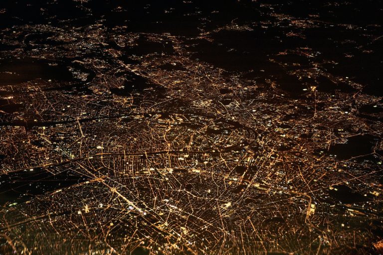
We all know that disasters can strike at any time, leaving behind a trail of destruction and chaos. In such situations, it is critical to have a clear understanding of the affected areas to coordinate relief efforts effectively. This is where cartography comes in, providing a vital tool for disaster management. Cartography, the art and science of map-making, has come a long way over the centuries, from quills and ink to digital tools that can create complex, interactive maps in real-time.
Today, cartography is an essential part of disaster management, providing critical information to first responders, aid agencies, and government officials. By mapping the affected areas, cartographers can help identify the extent of the damage, locate survivors, and plan rescue and relief efforts. Cartography can also be used to identify potential hazards, such as flood-prone areas or earthquake zones, allowing for proactive measures to be taken to prevent disasters from occurring in the first place.
Key Takeaways
- Cartography is a critical tool for disaster management, providing vital information to aid agencies, first responders, and government officials.
- The evolution of cartography has led to the development of digital tools that can create complex, interactive maps in real-time, making it easier to coordinate relief efforts effectively.
- By mapping the affected areas, cartographers can identify the extent of the damage, locate survivors, and plan rescue and relief efforts, as well as identify potential hazards, allowing for proactive measures to be taken to prevent disasters from occurring.
The Cartographer’s Toolkit: From Quills to Pixels
https://www.youtube.com/watch?v=lZ4rG0tX7D0&embed=true
As cartographers, we have come a long way from the days of quills and ink to the era of digital maps and GPS. The tools and technology we use to create maps have evolved significantly over the years, and we now have access to a vast array of mapping tools and technologies that help us create accurate and detailed maps.
Mapping Tools and Technology
In the past, cartographers would create maps using a variety of tools, such as quills, ink, and paper. However, today’s mapping tools and technology are far more advanced. We now have access to a wide range of digital mapping tools, such as GIS software, which allows us to create maps with greater accuracy and detail.
GIS: The Superhero of Maps
GIS, or Geographic Information System, is one of the most powerful mapping tools available today. It allows us to create maps that are more accurate and detailed than ever before. With GIS technology, we can analyze geographic data, create 3D models of terrain, and even simulate real-world scenarios.
Data: The Secret Sauce of Modern Cartography
One of the most critical components of modern cartography is data. Without accurate and reliable data sets, we cannot create accurate and reliable maps. Fortunately, we now have access to a vast array of geographic data, thanks to advances in remote sensing technology and the widespread use of smartphones and sensors.
In conclusion, the cartographer’s toolkit has come a long way from the days of quills and ink. Today, we have access to a wide range of mapping tools and technologies that help us create accurate and detailed maps. Whether we are using GIS software, analyzing big data sets, or leveraging the power of remote sensing technology, we are constantly pushing the boundaries of what is possible in the world of geospatial mapping.
When Disaster Strikes: Cartography to the Rescue
https://www.youtube.com/watch?v=6XIqtR9WxpU&embed=true
Disasters can strike at any moment, leaving chaos and destruction in their wake. Whether it’s a hurricane, earthquake, or pandemic, emergency responders need to act fast to save lives and mitigate damage. That’s where cartography comes in. By providing accurate and up-to-date maps of affected areas, cartographers can help emergency responders navigate the chaos and get aid to where it’s needed most.
Navigating the Chaos: Crisis and Disaster Response
When disaster strikes, the first priority is always to ensure public safety. Emergency responders work tirelessly to evacuate affected areas, provide medical care, and restore order. But with communication networks down and roads blocked, it can be difficult to know where to start. That’s where maps come in. By providing a bird’s eye view of the situation, cartographers can help emergency responders identify the most critical areas and coordinate response efforts.
The Role of Cartography in Emergency Management
Cartography plays a crucial role in emergency management. By providing accurate and up-to-date maps of affected areas, cartographers can help emergency responders navigate the chaos and get aid to where it’s needed most. But cartography isn’t just about creating maps. It’s also about analyzing data to identify patterns and trends that can help emergency responders make better decisions. By combining data from multiple sources, cartographers can create a comprehensive picture of the situation on the ground, helping emergency responders make informed decisions about where to allocate resources.
Ethics and Privacy: The Mapmaker’s Dilemma
While cartography can be a powerful tool in disaster response, it also raises ethical concerns. In order to create accurate maps, cartographers need access to a wide range of data, including sensitive information about individuals and communities. This raises questions about privacy and data breaches. Cartographers must be careful to balance the need for accurate information with the need to protect individual privacy. By following best practices and working closely with emergency responders, cartographers can ensure that their maps are both accurate and ethical.
In conclusion, cartography plays a crucial role in disaster response and emergency management. By providing accurate and up-to-date maps of affected areas, cartographers can help emergency responders navigate the chaos and get aid to where it’s needed most. But cartography also raises ethical concerns, and cartographers must be careful to balance the need for accurate information with the need to protect individual privacy. By working closely with emergency responders and following best practices, cartographers can help ensure that their maps are both accurate and ethical.
Frequently Asked Questions

How do cartographers save the day when Mother Nature goes rogue?
When Mother Nature unleashes her fury, cartographers become the unsung heroes who help us navigate through the chaos. They use their skills to create maps that show the extent of the damage, the location of survivors, and the areas that need immediate assistance. These maps are critical in helping emergency responders prioritize their efforts and save lives.
In a disaster flick, who’s the unsung hero with maps instead of capes?
In a disaster flick, the cartographer is the unsung hero who saves the day with their maps. They may not have superpowers, but they have the skills to create maps that can help people navigate through the chaos and find safety. They are the ones who create the treasure maps that guide us to safety.
Why are disaster maps the treasure maps for the modern-day Indiana Jones in emergencies?
Disaster maps are like treasure maps for the modern-day Indiana Jones. They guide us through the unknown, help us find our way, and lead us to safety. They are the maps that show us where to find the resources we need to survive, and the paths we should take to get there. They are the maps that help us navigate through the chaos and find our way to safety.
Can crisis mapping be the GPS for navigating out of chaos?
Crisis mapping is like a GPS for navigating out of chaos. It shows us where we are, where we need to go, and the best way to get there. It helps us avoid obstacles and find the resources we need to survive. It is the map that guides us through the chaos and leads us to safety.
What’s the superpower of humanitarian mapping in the face of calamities?
The superpower of humanitarian mapping is its ability to help us save lives in the face of calamities. It shows us where the most vulnerable people are located, where the resources are needed most, and where the greatest risks are. It helps us prioritize our efforts and resources, and make the most of our limited time and resources.
Why is a crisis map more vital than a Swiss Army knife in a survival kit?
A crisis map is more vital than a Swiss Army knife in a survival kit because it can help us navigate through the chaos and find our way to safety. It shows us where to find the resources we need to survive, and the paths we should take to get there. It helps us avoid obstacles and make the most of our limited time and resources. It is the map that guides us through the unknown and leads us to safety.