Map-tastic! Dynamic Mapping Solutions Take Interactivity to New Heights
Are you tired of using static maps that don’t provide you with the information you need? Do you want to know how technology has revolutionized the way we view maps? Look no further! In this article, we will explore the rise of dynamic mapping solutions and how they have changed the way we interact with maps.

Charting the Course: The Evolution of Maps from Static to Dynamic
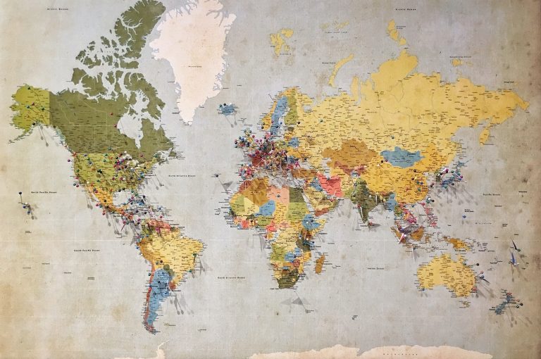
From paper maps to digital maps, maps have come a long way. With the advent of technology, maps have become more interactive and dynamic. Dynamic maps are maps that update in real-time and provide users with the latest information. Interactive maps, on the other hand, allow users to interact with the map and customize it according to their needs. With the rise of dynamic and interactive maps, users can now view maps in a way that was not possible before.
Navigating the Interactive Landscape: How Dynamic Maps Shape Our World
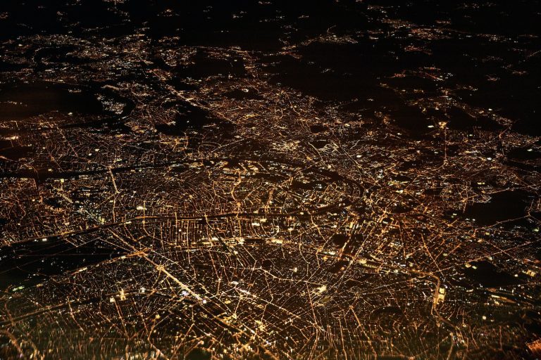
Dynamic maps have changed the way we view our world. With real-time updates, users can now see traffic updates, weather updates, and other important information that can impact their lives. Interactive maps have also made it easier for users to find their way around new places and discover new locations. With the help of technology, dynamic and interactive maps have become an integral part of our lives.
Key Takeaways
- Dynamic and interactive maps have revolutionized the way we view maps.
- With real-time updates, users can now view maps in a way that was not possible before.
- Dynamic and interactive maps have become an integral part of our lives.
Charting the Course: The Evolution of Maps from Static to Dynamic
https://www.youtube.com/watch?v=VVs8BKUroEc&embed=true
As cartographers, we’ve come a long way from ink and parchment to pixels and screens. The evolution of maps from static to dynamic has been a fascinating journey, and we’re excited to take you through it.
From Ink and Parchment to Pixels and Screens
Back in the day, maps were hand-drawn on parchment. It was a laborious process that required a steady hand and a keen eye for detail. Cartographers would spend weeks, sometimes months, creating a single map.
Fast forward to the digital age, and we now have access to powerful mapping technology that allows us to create digital maps in a matter of hours. These digital maps are not only faster to produce, but they’re also more accurate and more detailed than their hand-drawn counterparts.
The Tech Behind the Terrain: GIS and Dynamic Mapping Platforms
GIS (Geographic Information System) technology has been instrumental in the rise of dynamic mapping solutions. GIS allows us to collect, store, and analyze spatial data, which we can then use to create digital maps.
Dynamic mapping platforms like Google Maps and Apple Maps have taken GIS technology to the next level. These platforms use geospatial data to create interactive web maps that allow users to zoom in and out, pan across the map, and even get directions from one location to another.
The rise of dynamic mapping solutions has revolutionized the way we use maps. We can now access maps on our phones, tablets, and computers, and we can interact with them in ways that were once unimaginable.
In conclusion, the evolution of maps from static to dynamic has been a game-changer for cartography. With the help of GIS and dynamic mapping platforms, we can create accurate, detailed, and interactive maps that have changed the way we navigate the world around us.
Navigating the Interactive Landscape: How Dynamic Maps Shape Our World
https://www.youtube.com/watch?v=ohXMgdo-P4w&embed=true
Wayfinding in the Wild: Interactive Maps in the Public Sector
We all know how frustrating it can be to navigate a new city or neighborhood. But thanks to interactive maps, getting lost is becoming a thing of the past. From Google Maps to Waze, these dynamic mapping solutions are revolutionizing the way we get around.
But it’s not just about finding our way from point A to point B. Interactive maps are also being used in the public sector for emergency response, urban planning, and monitoring. With real-time data and connectivity, these maps are making our cities safer and more efficient.
The Lay of the Land: User Interaction and Experience
Of course, all of this connectivity and usability means nothing if the map user can’t actually use the map. That’s where user interaction and experience come in. Dynamic maps must be accessible and easy to use, no matter what device or screen size they are being viewed on.
This is especially important for indoor maps, which are becoming increasingly popular in places like malls, airports, and museums. Indoor maps must be accurate, easy to navigate, and provide information on points of interest (POIs) within the space.
Mapping Out the Future: Trends in Dynamic Mapping Solutions
As with any technology, dynamic mapping solutions are constantly evolving. One of the biggest trends we’re seeing is the rise of Internet of Things (IoT) devices and their integration with mapping solutions. From smart homes to smart cities, IoT is changing the way we interact with our environment.
Another trend is the increasing focus on maintenance and safety. Dynamic mapping solutions must be regularly updated and maintained to ensure accuracy and usability. And with the rise of smart cities and connected devices, safety is more important than ever.
In conclusion, interactive maps are changing the way we navigate our world. From wayfinding to urban planning, these dynamic mapping solutions are making our lives easier and more efficient. But it’s important to remember that accessibility, usability, and safety must always be top priorities.
Frequently Asked Questions

Why do interactive maps have all the fun, and topographic maps get left with just the contours?
Well, we think it’s because interactive maps are like the cool kids in school – they’re always up for a good time and know how to have fun. But don’t worry, topographic maps are still important! They may not be as flashy, but they provide valuable information about the terrain and elevation.
If I whisper sweet nothings to an interactive map API, will it show me the world?
Unfortunately, sweet nothings won’t work on an interactive map API, but learning how to use it will! Interactive maps are powerful tools that can help you visualize and analyze data in ways that were never possible before.
Are the best things in life free, even the best interactive maps online?
Some of the best things in life are free, and that includes some of the best interactive maps online. There are many free and open-source mapping solutions available that can help you create stunning interactive maps without breaking the bank.
Can I pin my dreams onto an interactive map, or should I stick to locations only?
You can definitely pin your dreams onto an interactive map! In fact, interactive maps can be used for a wide range of purposes, from visualizing data to planning travel routes. So go ahead, dream big and map it out!
Is coding an interactive map the modern-day love letter to cartographers?
We like to think so! Coding an interactive map is a labor of love that requires skill, creativity, and attention to detail. And just like a love letter, a well-crafted interactive map can be a thing of beauty that inspires and delights.
If I create an interactive map of the United States, will it help me find where I left my car keys?
As much as we wish it were true, an interactive map of the United States won’t help you find your lost car keys. However, it can help you explore the country in new and exciting ways, and maybe even inspire you to take a road trip to find those elusive keys!