Map-tivating Minds: How to Make Geography Fun in the Classroom
Geography is often overlooked as a subject in schools, but it is an essential part of our lives. It is the study of the world, its people, and the environment that surrounds us. Geography helps us understand the world we live in and how we can protect it. It is crucial for students to learn about geography and its importance in their lives.

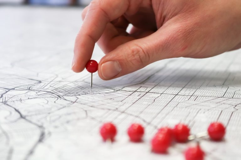
Maps are an integral part of geography. They are used to represent the world and its features, making it easier for students to understand the world around them. Maps provide a visual representation of the world, and they can be used to teach a variety of skills such as reading, interpreting, and analyzing information. Maps can be used to teach students about different cultures, languages, and traditions. They can also be used to teach students about the environment and how it affects our lives.
Key Takeaways
- Geography is an essential subject that helps students understand the world and how to protect it.
- Maps are an integral part of geography that provide a visual representation of the world and can be used to teach a variety of skills.
- Using maps to teach geography can help engage young students and teach them about different cultures, languages, traditions, and the environment.
Maps: The World at Your Fingertips
https://www.youtube.com/watch?v=0ZlLez0hFHw&embed=true
Ah, maps. Those colorful, squiggly-lined, and sometimes confusing diagrams that depict the world around us. They can be found in classrooms, on our phones, and even on our walls. But what makes them so important? Let’s dive in and explore the art of mapmaking, navigating the digital seas, and the old school cool of paper maps.
The Art of Mapmaking
Mapmaking is truly an art form. It takes skill, knowledge, and patience to create a map that accurately represents the world. From the compass rose to the latitude and longitude lines, there are many components that make up a map. And let’s not forget about the map key, which helps us understand the symbols and colors used on the map.
Navigating the Digital Seas
In today’s digital age, online maps have become the go-to for many of us. Google Maps and National Geographic’s MapMaker are just a few examples of the many online mapping tools available. We can easily find directions, see satellite images of our homes, and even create our own custom maps using tools like Google My Maps and Google Earth.
Paper Maps: Old School Cool
But let’s not forget about the old school cool of paper maps. There’s something special about holding a physical map in your hands and tracing your finger along the roads and landmarks. And let’s be honest, there’s a sense of satisfaction in being able to fold a map back up correctly.
Whether you prefer digital or paper maps, having map skills is an important part of geography education. Knowing how to read a map and understand its components can help us navigate the world around us. So let’s embrace the world of maps and explore all that it has to offer.
Geography Goes Live: Engaging the Young Explorers

As geography teachers, we know that engaging young learners can be a challenge, but with the right tools and attitude, we can make it fun and exciting. In this section, we will explore some creative ways to teach geography and engage students with maps.
Virtual Globetrotting
Technology has made it easier than ever to take students on virtual field trips around the world. With tools like Google Earth and National Geographic Explorer, we can explore the world from the comfort of our classrooms. We can visit famous landmarks, explore different cultures, and learn about the environment and climate of different regions.
Geography: More Than Just Places
Geography is more than just memorizing the names of countries and their capitals. It’s about understanding the connections between people, places, and the environment. We can use geography lessons to teach students about history, science, social studies, and math. We can show them how geography affects our lives and how we can make a positive impact on the environment.
The Great Geography Gamification
Gamification can be a great way to engage young learners. We can create scavenger hunts, pen pal programs, and geography puzzles to make learning fun and interactive. We can also use tools like Kahoot and the Geography Bee to test their knowledge and make it a learning experience they won’t forget.
We can also encourage creativity and support careers in geography by introducing students to cartographers and other professionals in the field. We can show them how geography is an exciting and dynamic field that offers endless opportunities for exploration and adventure.
In conclusion, by making geography fun and engaging, we can help young people develop a positive attitude towards education and learning. As educators, we have the power to make a difference in their lives and inspire them to become the next generation of National Geographic explorers and geography teachers. Let’s make the most of this learning experience and show them the wonders of the world through the power of maps!
Frequently Asked Questions

How can maps in class save students from the ‘I thought Europe was a country’ dilemma?
Maps can be an effective tool to help students visualize and understand the world around them. By using maps in the classroom, teachers can help students develop a more accurate understanding of geography and avoid common misconceptions. In fact, research has shown that using maps in the classroom can lead to better retention of information and improved critical thinking skills.
What’s the deal with map of the month – do they get shinier with each passing month?
Map of the Month is a great way to keep students engaged and excited about geography. Each month, a new map is displayed in the classroom, and students are encouraged to explore it and learn more about the region it represents. While the maps may not get shinier with each passing month, they do provide a fun and interactive way for students to learn about the world.
Can geography posters outshine teen pop idols on classroom walls?
Geography posters can be a great addition to any classroom, helping to create a visually stimulating environment that promotes learning. While they may not outshine teen pop idols, they can certainly help to capture students’ attention and interest. By displaying posters that highlight different regions of the world, teachers can help students develop a better understanding of geography and the world around them.
Why do teachers wave maps around, plotting to conquer student boredom?
Maps are a powerful tool for engaging students and promoting learning. By using maps in the classroom, teachers can help students develop a more accurate understanding of geography and the world around them. Whether it’s through interactive activities or simply displaying maps on the wall, teachers can use maps to conquer student boredom and promote a love of learning.
Are there any map activities that won’t lead to students mistaking Greenland for the biggest continent?
Yes! There are many map activities that can help students develop a more accurate understanding of geography without leading to common misconceptions. For example, teachers can use maps to teach students about different climate zones, landforms, and cultural regions. By using a variety of activities and approaches, teachers can help students develop a well-rounded understanding of geography.
How might interactive maps in class lead to a student’s ‘Eureka!’ moment without the need for a bathtub?
Interactive maps can be a powerful tool for promoting learning and engagement in the classroom. By allowing students to explore maps and interact with different regions of the world, teachers can help students develop a deeper understanding of geography and the world around them. Whether it’s through virtual field trips or interactive quizzes, interactive maps can help students have a ‘Eureka!’ moment without the need for a bathtub.